HURRICANE ERIN THREATENS COASTAL AREAS.
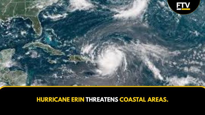
Hurricane Erin has intensified into a powerful Category 4 storm, packing maximum sustained winds of 130 mph (215 kph). As of early today, the storm began affecting the southeast Bahamas and the Turks and Caicos Islands, according to the U.S. National Hurricane Center (NHC) in Miami.
Around 2 a.m. today, Hurricane Erin was located about 110 miles (175 kilometers) northeast of Grand Turk Island and roughly 935 miles (1,500 kilometers) south-southeast of Cape Hatteras, North Carolina. The storm moved northwest at 12 mph (19 kph) and is expected to strengthen further before gradually weakening.
Hurricane-force winds extend up to 60 miles (95 kilometers) from the center, while tropical-storm-force winds reach outward up to 230 miles (370 km). This large wind field will impact coastal areas, even without a direct landfall.
Subsequently, Dare County, North Carolina, has declared a state of emergency on August 17. Officials ordered an evacuation of Hatteras Island on the Outer Banks. Heavy surf and high winds could wash out parts of N.C. Highway 12, which runs along the barrier islands.
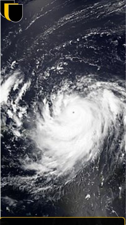
Despite being downgraded to a Category 3 storm, hurricane Erin is forecasted to grow in size as it approaches the Bahamian Archipelago. The storm reached Category 5 status on Saturday night, with winds of up to 160 mph (260 km/h). Meteorologists predict that Erin will continue to expand over the next few days.
The NHC warns that tropical-storm-strength winds could extend 205 miles from the storm’s center. Areas in the Virgin Islands and Puerto Rico may experience flash flooding and landslides due to storm-related hazards. Hurricane Erin marks the first hurricane of the 2025 Atlantic season, and it is not expected to make landfall on the mainland U.S.
Hurricane Erin rapidly intensified as it moved toward the Caribbean, with NHC director Mike Brennan noting its explosive development. However, the storm’s forward movement slowed as it began to turn north away from the Caribbean. The NHC anticipates that hurricane Erin will continue to drift away from the U.S. and back into the Atlantic.
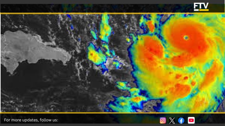
As the storm passes north of Puerto Rico and the Dominican Republic, it maintains winds of up to 125 mph. Rainfall in the Virgin Islands and Turks and Caicos Islands may reach 6 inches (15 cm) by Sunday. Tropical storm warnings remain in effect for the Turks and Caicos Islands, where strong winds and dangerous rip currents are likely.
Mike Brennan emphasized that hurricane Erin will generate life-threatening surf swells and rip currents along almost the entire U.S. East Coast. Florida and mid-Atlantic states will experience the most hazardous surf conditions. Bermuda may also face dangerous surf and heavy rainfall as hurricane Erin continues its path.
Due to gale-force winds, the U.S. Coast Guard has imposed restrictions on vessels at ports in the U.S. Virgin Islands and several municipalities in Puerto Rico, including San Juan. The National Oceanic and Atmospheric Administration (NOAA) predicts an above-normal Atlantic hurricane season, with an increased likelihood of storms reaching Category 4 and 5 due to global warming.


Post Comment